انتشارات Esri
Building a Geodatabase: ArcGIS 9
Editors of ESRI Press, 2005
Editing in ArcMap: ArcGIS 9
Editors of ESRI Press, 2005
Geocoding in ArcGIS: ArcGIS 9
Editors of ESRI Press, 2005
Geodatabase Workbook: ArcGIS 9
Editors of ESRI Press, 2004
Geoprocessing in ArcGIS: ArcGIS 9
Editors of ESRI Press, 2004
Getting Started with ArcGIS: ArcGIS 8
Editors of ESRI Press, 2001
Getting to Know ArcGIS Desktop
Tim Ormsby, Eileen J. Napoleon, Robert Burke, Carolyn Groessl, Laura Bowden, 2010
Linear Referencing in ArcGIS: ArcGIS 9
Editors of ESRI Press, 2005
Using ArcGIS 3D Analyst: ArcGIS 9
Editors of ESRI Press, 2004
Using ArcGIS Spatial Analyst
Jill McCoy Kevin Johnston, 2002
Using ArcGIS Spatial Analyst: ArcGIS 9
Editors of ESRI Press, 2004
A Review of Irish Energy Policy issue 21
Debora Mahlke (auth.), 2011
Using ArcMap: ArcGIS 9 (Arcgis 9)
ESRI PressESRI Press (Editor)Editors of Esri Press (Editor), 2004
What Is ArcGIS 9.1?
ESRI Press, 2005
GIS Tutorial 1: Basic Workbook
Wilpen L. Gorr, 2010
GIS tutorial II: spatial analysis workbook, Issue 1
David W. Allen, 2009
Designing Better Maps: A Guide for GIS Users
Cynthia A. Brewer, 2005
Exploring ArcObjects (Two Volume Set)
Michael Zeiler, 2001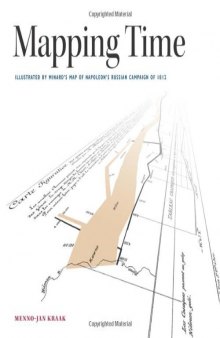
Mapping time : illustrated by Minard's map of Napoleon's Russian Campaign of 1812
Menno-Jan Kraak, 2014